First, a quick reminder - you can click or double click on the photos to see an enlarged version. Just click your "Back" button to resume viewing the blog. Many of the scenery photos really are much more enjoyable in larger format.
Now, ON WITH THE SHOW . . .

From the moment Susan said she wanted to do the approximately 220 miles on the John Muir Trail, I was sold. The longest backpack, in # of days, that I had done previously was 7 days and I felt as though I was just getting in the swing of it when it was time to come home. This was my chance to test myself physically and mentally on a much longer trek.
Once we decided we actually wanted to do this, the planning began. We wanted to go in August, prime time weather-wise so we needed to try for a permit in February. The permit process can be quite frustrating as you must fax your application on a specific # of days before your preferred start day. You must put in your 1st, 2nd, and 3rd choices of beginning trailhead and pray they pick yours that day. If not, you do it all over again the next day and the next until you either get accepted or you end up too late in the Fall season to safely avoid winter weather at those altitudes. Keep in mind that hikers from all over the world are vying for those permits.
Thanks to Susan's timing and determination, our application was accepted with our 2nd choice of trailhead, Glacier Point, in Yosemite.Wahoo! That was THE big obstacle. Everything else was simply planning and spending!
Being out that long means setting up re-supply locations where we can pick up more food, t.p., ibuprofen, etc. You know, the important stuff! After a fair bit of research we planned to deliver 3 re-supplies as we drove up to Yosemite, mail one since there was no eastern access, and we still had one more to work out. We already arranged for a pack outfitter to deliver a re-supply to Charlotte Lake, before our last 6 days, and that wasn't cheap. We had another tough-to-get-to location that required someone to bring it up and the pack outfitter for that area charges $650 plus Nat'l Forest access fees. Now, you break that down into how many dollars per lb. of stuff delivered and it works out to about $65/lb. Trust me, backpacking food really isn't that good!
Our angels in the form of friends, David and Shirley, came to our rescue. As David has a brother that lives in Bishop, the little town just east of the trailhead, David and Shirley decided to go for a visit and, while there, backpack in two days to bring us 10 lbs. of food in a 2 1/2 lb. bear canister! If you don't backpack, you might not fully appreciate what a huge thing that is. We count ounces when deciding what to take or leave. To have an additional 12-13 lbs. is huge. We couldn't believe they were willing to do that. But thank our lucky stars they were.
Next obstacle, we needed a car at the end of the journey and we had to get to the beginning. Well, we would just drive two cars, leave one at Whitney Portal and drive on up depositing our re-supply buckets along the way. Kind of a drag driving two cars and really a drag having to drive all the way back up to Yosemite to pick up that car, about 5 hours spent getting further away from home!
Well, we had two more angels come to our rescue. Friend, Judi, and her sister, Ellie, decided it was about time for a road trip and Yosemite sounded good to them! Wow. So they drove their van, we drove Susan's SUV. We dropped the SUV at Whitney and all loaded up in the van for the trek north.

The back of JudI's van with our backpacking gear thrown in.
 The van only has one back seat so we improvised. Susan found it quite comfortable.

We delivered our buckets to the pack outfitter that was to bring them over Kearsarge Pass for our final infusion of groceries.

Those are our two white buckets in the center.
Keep in mind that these places aren't just off the road. We had to drive 15-20 miles off the highway on dirt roads, turn left at the bent board or turn right where ole Farmer Jake's gate used to be. You know the sort of thing.
We stopped and dropped off another at Red's Meadow Resort (I use the term "resort" loosely) and spent the night there, camping as we could not get a reservation in their in-demand very rustic cabins. We did enjoy the afternoon there.

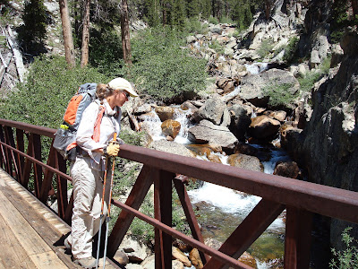
Betsy, Judi, and Ellie on the bridge.
We visited the Devil's Postpile which is quite a popular visitor "must see". But now you don't have to drive all the way to California. You can see it right here!


The hexagonal formation goes all the way through to form elongated formations that you see from the side in photo above.
The next day we headed north again toward Yosemite National Park. We took a little side trip to see some interesting formations in Mono Lake near Lee Vining.


This is called tufa. We were mistakenly referring to it as tofu for awhile.
According to Susan, these look "moony." Judi thought they looked more "lunar."
We proceeded on to Tuolomne Meadows for another re-supply drop. We had been worried because the drop is at the post office which closes at noon on Saturdays and is closed on Sundays. Susan and I would be hiking in on a Saturday and were a bit anxious about getting there before noon. If we missed it, we wouldn't be able to proceed on until the following Monday thus losing a day and 1/2, no good. But, Dave the postman put us at ease. He's that kind of guy, as you can see.

"No problem. I have it all under control."
It seems the cafe', the post office, and the store are all connected. He jumped up on the counter, placed our bucket on the ledge overlooking the store and told us to just point it out when we came in, they'd get it for us. Whew. What a relief.

Next stop, Yosemite National Park. I had never been there. Susan had so she was an invaluable source of information which allowed us all to see as much as we could in a very short time. She and I had rented a tent cabin for two nights. Since Judi and Ellie decided later to come on this journey and no tents were available, they had campsites and slept in the van. I think they had the better deal! Those tent cabins are minimum $100 night! And none of the comforts of home.

But for the $100 you get a chair, a bear box,

and beds! The one thing you don't get, for sure, is privacy. We learned very quickly to not get dressed/undressed at night with the single pull-chain light bulb on.
 Judi and Ellie got to see this bear lumber past their campsite.
 But they also got to suffer a flat tire. Fortunately, chivalry is not dead and these young men helped to get it changed.


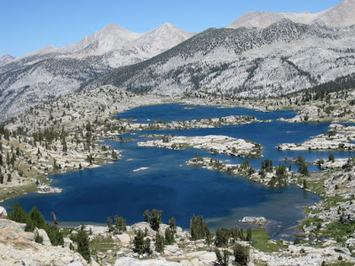
We spent the next two days exploring Yosemite which is quite dramatic and lovely.

Looking down the valley.

Half Dome in the center. Climbers actually scale the face (flat part) of this. It takes days and they are on ropes the entire time. In a couple of days we will be climbing it from left to right in the photo, not on ropes but holding onto cables . . . for dear life.

Ellie and Judi posing with the Minarets in the background.
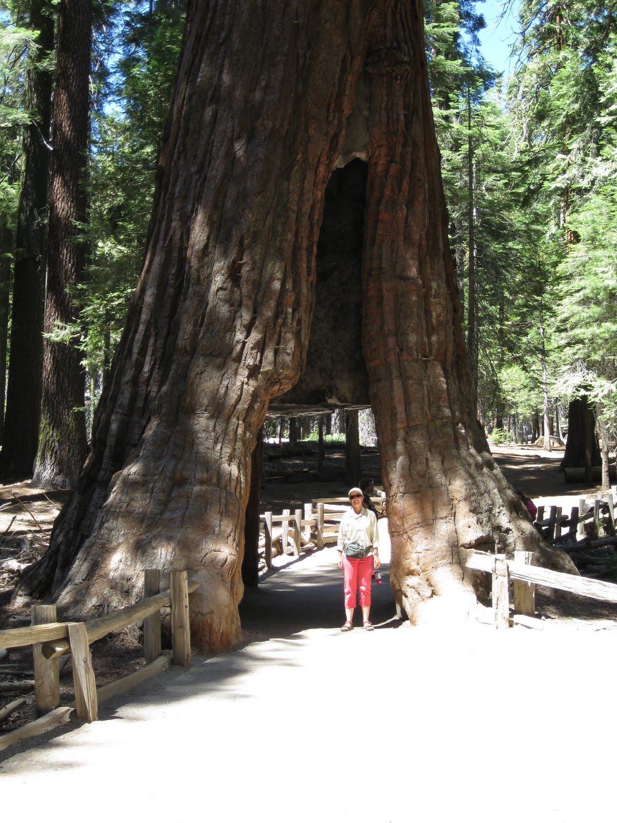

We visited the Mariposa area of the large Sequoia trees. It's impossible to get an entire tree in a photo!

This is where I learned what happens when you apply sunscreen before walking around in the dirt in sandals. Lovely.
The next day Judi and Ellie trundled us up to Glacier Point for the beginning of our John Muir Trail adventure. It was surprisingly emotional.
 Strapping on everything we'll own for the next month. It's a powerful feeling that holds some tiny inkling of trepidation. Still time to wonder what we've forgotten but too late to do anything about it!
 We took the Panorama Trail to hook up with the official John Muir Trail.
Get used to these clothes. You'll see a lot of them.

 Every journey begins with but a single step. . .
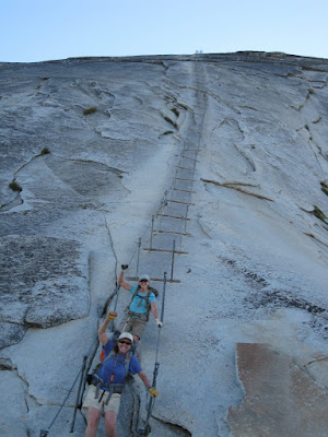
I admit I was a bit concerned when we were hiking up about 4:30 p.m., the only two going that direction. But, it worked great because when we got on the cables there were only a few other people on them which made it much less stressful and it was quite pleasant on top without hundreds of people. We were two of eight on the top at about 5:30-6:00.


Get used to these clothes. You'll see a lot of them.


We thought our first day would be all downhill as we were starting at a high point. So silly. So naive. NOTHING in the mountains is EVER downhill for the entire day. It just doesn't happen. But we completed our first day without incident. Saw beautiful country and knew we were on our way.
Now here is where I should tell you that I am inserting my actual, unedited journal entries in their respective spots as best I can figure. I will put them in blue (as above). Feel free to skip them if you're not interested. It won't hurt my feelings.
Day 2 - Ugh! 7:15 - moving slow but back doesn't hurt! Uphill 2 1/2 miles - camp - Half Dome late in day. Sweating like a pig, 30 lb. pack on my back and it's a stray hair touching my arm that's driving me crazy! Half Dome conquered! 1st bear encounter!
We camped at a relatively high use area the second day so we could rest up and go back to do Half Dome that afternoon. All along the trail, people we spoke to were planning to get up REALLY early in the morning to "beat the crowd" but so many people said the same that we quickly decided that they WERE the crowd. So we decided to go late to avoid the crowd that was avoiding the crowd. Hah.

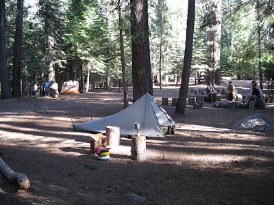
Our first campsite at Little Yosemite Valley.
Day 1 - Glacier Point to Little Yosemite Valley or beyond. We decided at 4 miles there would be "No beyond". Camp very nice; toilets, water near and Beach! Community fire pit. Nice people. Took drugs (advil) and slept well. Hope to get routine down soon.
Now here is where I should tell you that I am inserting my actual, unedited journal entries in their respective spots as best I can figure. I will put them in blue (as above). Feel free to skip them if you're not interested. It won't hurt my feelings.
Day 2 - Ugh! 7:15 - moving slow but back doesn't hurt! Uphill 2 1/2 miles - camp - Half Dome late in day. Sweating like a pig, 30 lb. pack on my back and it's a stray hair touching my arm that's driving me crazy! Half Dome conquered! 1st bear encounter!
We camped at a relatively high use area the second day so we could rest up and go back to do Half Dome that afternoon. All along the trail, people we spoke to were planning to get up REALLY early in the morning to "beat the crowd" but so many people said the same that we quickly decided that they WERE the crowd. So we decided to go late to avoid the crowd that was avoiding the crowd. Hah.
I admit I was a bit concerned when we were hiking up about 4:30 p.m., the only two going that direction. But, it worked great because when we got on the cables there were only a few other people on them which made it much less stressful and it was quite pleasant on top without hundreds of people. We were two of eight on the top at about 5:30-6:00.

This is what the cables look like as we approach. You can see a person at the top. Earlier in the day all the people on them looked like an ant trail going up the side.
It is really quite anxiety-inducing!

Susan making her way. She confessed later that she SERIOUSLY considered turning back several times. She doesn't like heights.

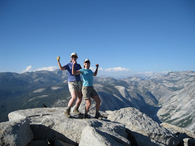
Yep, we made it. Had to show off our muscles.
 Climbing Half Dome was Susan's idea and I felt I should express my gratitude.
 View of Yosemite Valley from the top.
 People are not supposed to feed the wildlife but as you can see from this marmot, they might be. Trust me, there is NOTHING natural up there for him to eat.
 View coming back down. Those cables are our lifeline and we held onto them with that in mind!
 Wahoo! We did it! Coming down was almost scarier than going up.


 This guy had him some fresh horse poop and he wasn't relinquishing it to anybody!
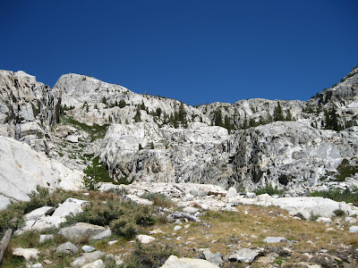
 Lovely granite with green, wildflowers, and little ponds everywhere.
 Susan enjoyed her Reese's treat while I. . .
 had a little pedicure and toe doctoring.
 Crossing some water on our way to Island Pass.
 Ah. Made it over Pass Number 2 - Island Pass 10,221 ft.
(It is sometimes challenging to find a good camera pedestal!)
 Tents set up with backdrop of Banner Peak.
Day 6 - Clear blue skies and Donahue Pass. East side breathtakingly beautiful. Sat and enjoyed more than usual. Wildflowers abundant. Granite spectacular. Island Pass long and end of day but worth it as at 10,000+ ft. and lakes next to high peak. Yowser! Each day a new/different pain. Yesterday hip, today shoulder, tomorrow who knows! Isn't this supposed to get easier?!
 This must be breakfast cuz Susan looks cold!
 Banner Peak from another angle with the scenic Thousand Island lake in the foreground.
 Sometimes we found lovely, sturdy bridges like this one at Garnet Lake.
 Some rather rocky trail coming down from that pass. This is Susan's favorite stuff (dripping with sarcasm here). You should probably know that Susan has terrible feet, all sorts of problems. How she managed to backpack on some of the trail we had and the distances we did, I will never know.
 All along the length of the JMT were trail crew improving or repairing it. This is Acea, a young man that does some very hard work so we can all enjoy the wilderness.
 Lovely streams and waterfalls.
 Always a nice spot for a snack.
 Pretty water and reflections.
 A burned area just beyond Red's Meadow. The new growth is all the more lovely next to that lost.
 Big view of where we came from earlier that day (the valley in the center).
 Don't quite remember what we're celebrating here. Probably managing to get up some endless switchbacks climbing a ridge. Definitely worth celebrating.
 Sometimes we made use of the fire rings just to burn our t.p. It gets to weighing ya down after 6 or 7 days!
 Pretty view.
 Once ya get up it's time to head back down, to Tulley's Hole this time.
 More lovely streams and falls. Hmmmm, must be time for a break!
 Susan trying to finish her lunch that JUST WON'T END.

Betsy checks out the rocks, and IN she goes!
 Just kiddin'. Had to stage a little drama.
 You just never know if it'll be water. . .
 Pass Number 3 - Silver Pass 10,754 ft.
 Where we came from earlier that day, I think.
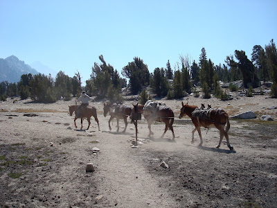
A lot of people visit Vermillion Valley Ranch because they have cabins, beds, showers, and food. BUT you have to hike another 1.5 miles to catch a ferry across 5.7 miles of Edison Lake and the ferry only runs twice a day, 9 something a.m. and 4 something p.m. That just didn't jive with our schedule and we didn't want to add 3 miles to our distance so we skipped it. We knew we had a booger of a ridge to climb up the next morning, Bear Ridge, so we rested up for that.


The campsite we had for this day was in an area, it seemed, that was regularly patrolled by a hungry bear. We ended up chasing him out of our camp 6 or 7 times from the time we set up until the time we left the next morning. We learned he had walked into a camp a few days earlier while the people were eating dinner. They just got up and backed away leaving their food for his enjoyment. BIG MISTAKE. He seemed rather empowered by that success and thought he'd keep giving that strategy a try. I fear he'll be removed by rangers before too long.

Here he is sneaking through the ground cover by our site. He was VERY quiet. Once, we were sitting on the ground, backs against a log enjoying our lunch when up pops his head from a low spot about 50 feet away! I jumped up and chased him away, hollering and clapping, while Susan put our food safely into the bear canister and joined in the chase. He's not getting our lunch!

He wasn't real big although he seemed bigger the first time I saw him. But he was big enough to tear up stuff if he wanted to. The day before, someone left a washed pan in their tent while they went hiking. He tore their tent apart getting to that pan. We didn't want him tearing into our tents so anything with a possible aroma went into the bear canisters.
We headed south on the trail the next morning and passed through some lovely country. I'll try to remember which photos were where. Keep in mind, we took A LOT of photos. You might want to take a break every once in a while. And remember, you can click on photos to see them full size.
Day 3 - Pain. Sore. Chased bear for 6th time. Late start, so tired. Uphill. Kill me now. Camp at Sunrise Camp. Lovely but black sooty dirt - ick. Beautiful setting.

Interesting pinnacley type mountains. (Yes, I know that isn't a word.)

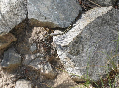
Local wildlife.

Cathedral Peak on right and Cathedral Lake on left.


Getting water along the way. Water was plentiful along the entire 195 miles we traveled with a few exceptions. We used chlorine dioxide tablets rather than a filter to save weight and avoid clogged or broken filters along the way.

The night of day 4 was spent in the backpackers campground at Tuolumne Meadows. Due to the constant high use here, each site had a bear box and, thank goodness, a picnic table. We picked up our re-supply bucket here AFTER we had ice cream and french fries and sodas! As you can see, we took full advantage of the table to get ourselves organized once again.
Day 4 - Up at 6! That's what happens when in bed at 8:30. 10 miles. Re-supply at Tuolomne. Dairy craving - ice cream bar, cheese, chocolate milk. Susan had cheeseburger and french fries and, of course, two diet cokes. 1st thunder and a few raindrops.

Susan leading the way on some rather rocky trail.
Day 5 - 10.6 miles. Oooy feet. Tuol. to Lyle Forks. Level until last mile - cruel! Barely set up before rain and grappel, cold. Thank you geese for your down! Tomorrow, our first pass, 9657 to 11073. Pray for good weather.

Yep, still snow in August.
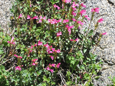
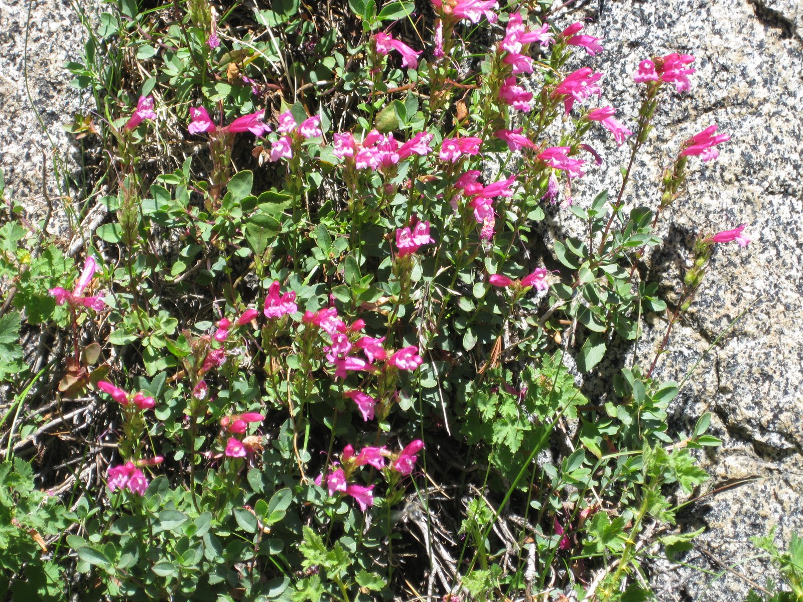
 I think that the late melting snowpack resulted in a late wildflower season (not to mention a late mosquito season!). We saw some vibrant colors and I'm going to share some of those with you here rather than sprinkle them throughout the other photos.
 These were Susan's favorite.
 You can see it better here. I believe it is in the columbine family and may be called the Shooting Star.
 We enjoyed the mixture of colors also.
 The tiger lillies were not prevalent but they were beautiful.
 I thought these were interesting in the way they created their own little bouquets.
 Some of the flowering plants grew in the most unlikely places and provided such a contrast to the stark, rocky surroundings.
 These guys were teeny tiny itsy bitsy.
 If you enlarge this photo you will see many different colors in the tundra-type soil. There was beauty everywhere because the plant life was in full force during our visit.


We're going over Donahue Pass soon. This is a view of where we came from earlier that day.

We got to trek through some of that snow. It had some pink areas that, I believe, are some sort of fungus or something. Given that is melting into our water sources, I sure hope those tablets are up to the task!

Pass Number 1 - Donahue Pass 11073 ft. We did it!


(It is sometimes challenging to find a good camera pedestal!)

Day 6 - Clear blue skies and Donahue Pass. East side breathtakingly beautiful. Sat and enjoyed more than usual. Wildflowers abundant. Granite spectacular. Island Pass long and end of day but worth it as at 10,000+ ft. and lakes next to high peak. Yowser! Each day a new/different pain. Yesterday hip, today shoulder, tomorrow who knows! Isn't this supposed to get easier?!


Day 7 - Island Pass to Rosalie Lake - up down up down. Lots of beautiful lakes and regained elevation. Time to wash body and clothes in gallon Ziploc bag. Luxury.
Day 8 - Rosalie Lake to Red's Meadow. Not much to look at really, just get there. Hot showers (ooooyeah) and cafe', re-supply for 7 days! Phone calls - all well. Need to write "Ode to Dirt" and "Ode to Feet". D and S bringing me another pair of socks. I owe them big!
While at Red's Meadow we managed a hot shower! Now, don't go crazy. I'm sure you're picturing something far, far different from what was there. I wish I had taken a photo but, alas, I did not take my camera with me for this particular activity. There was a line of about 6 rooms, each having its own door. There was one small slatted window in each room so it was kind of dark in there. Good thing, too, cuz only backpackers who are in desperate need of a bath would not flee from these. Each room had a large concrete tub with a drain and the shower spout out of the wall. The control worked only the amount of water, not the temperature since all the water was from a geothermal spring. Whatever the temperature is, it is. Live with it.
The tubs were somewhat scummy and wet because about 8,000 people had been in there before me. I know, ooooyuuuu. BUT, there were hooks on the wall and there was hot water and there was a latch on the door and I stayed in there until I washed my hair, my body, and my clothes at least three times! So, I was happy. And, yes, I did wear shoes in the shower!


Day 9 - Out of Red's late, shuttle, etc. Ack flies! Horrible 6 mile stretch! Advise others to avoid! Stopped at Deer Creek Xing cuz no water for next 5.5 miles and no way we're going 11 miles today. HOT!

Day 10 - Tough day physically. Body tired. From Deer Creek to Purple Lake. Found nice spot, set up, and an hour later a group of 10-12 teen boys with leaders set up about 50 ft. away. One is ADHD or something - yikes. Hoping tomorrow better both stronger and prettier. Ah HA! Realized it's Friday 13th! That explains all.


Betsy checks out the rocks, and IN she goes!


or snow!


Day 11 - Amazing what 12 hrs. sleep and Mom's bean stew can do. Feel great today. Stopped at Virginia Lake - beautiful spot for snack. Mosquitos still plentiful and annoying. Tulley's Hole very pretty. Thought we'd never get over Silver Pass but we did. Camped at Silver Lake +/- 9.5 miles.
A lot of people visit Vermillion Valley Ranch because they have cabins, beds, showers, and food. BUT you have to hike another 1.5 miles to catch a ferry across 5.7 miles of Edison Lake and the ferry only runs twice a day, 9 something a.m. and 4 something p.m. That just didn't jive with our schedule and we didn't want to add 3 miles to our distance so we skipped it. We knew we had a booger of a ridge to climb up the next morning, Bear Ridge, so we rested up for that.

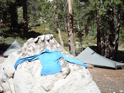
I always like to air my clothing in the sun when possible.

As sun is setting. I thought it was purdy.
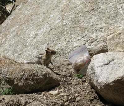
Day 12 - Downhill all the way! Not going to Vermillion Valley Ranch due to time. Did some laundry. On trail on way out someone left their snack bag. Watched a chippy explore and investigate. Couldn't believe his luck. Looked around to see who was filming him on Candid Camera.


Day 13 - Up at 6, on trail 7:30! Up Bear Ridge 2000+ ft. immediately. Whew. Over 3400 ft. vertical today. 10 miles. Tired! Outfitter told us good sites, only 1 mile from Bear Xing, a little uphill. It was 1.5 miles and ALL uphill. Exhausted. In bed now at 7:30 p.m.

We finally made it to Rosemarie Meadow and collapsed into the first campsite we found. I swore I'd take my revenge on that outfitter for telling us it wasn't much uphill. But, again, we made it and before many others that ventured to that point that night.


Day 15 - Down, down, down to Muir Trail Ranch. Pretty rustic. No rooms available so no showers, booo. Hair is gross. Resupplied. Found goodies in buckets i.e. medical tape, sunscreen, t.p. Used email and bought more fuel and bug spray. Thought we'd go on but after short uphill with new weight, decided to camp by river and visit Blayney hot springs. Primitive but quite warm. Gave trail names today. Susan is Juke Box and I'm Dreamer. Almost went with "Feet" and "Toes".


Day 16 - Out of Muir Trail Ranch. Nice gradual. Out of John Muir Wilderness and into Kings Canyon NP. Different terrain. Went from San Joaquin River to Evolution Creek but only after climbing up, up, up.


Day 17 - Up to Evolution then Sapphire Lakes. Severe and lovely setting. Mosquitos terrible! A couple, Robert and Linda, set up tent right next to mine. Not too happy about that but, se la vie, eh? My fingers are cracking and hurt. Can't put enough lotion on them. Feet doing okay so far. Glide stuff works well. Looking forward to clean socks. Tomorrow is off day. Going to wash hair, body, clothes. Yahoo! It's going to be cold tonight.


 Some of the mountains could be rather imposing.
 Wanda Lake
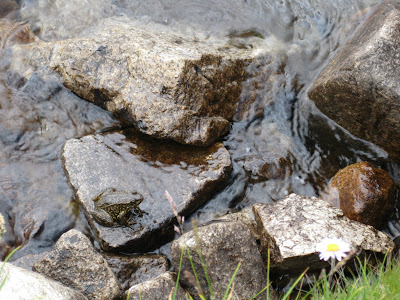 I saw dozens of frogs along the bank of Wanda Lake.
 Pass Number Five - Muir Pass 11,991 ft.
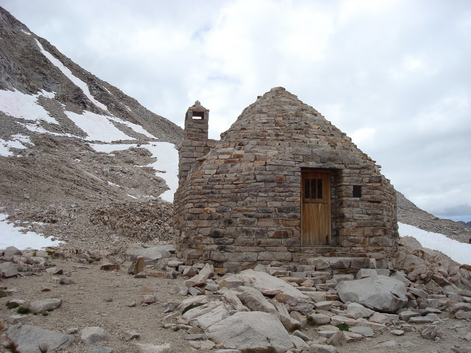
Muir Pass Hut built by the Sierra Club in honor of John Muir.
As it is located on a very exposed pass, hikers may seek refuge here during lightening storms. Not intended for overnight use, however.


Day 18 - Planned rest day but woke to strong winds and cloudy skies. We packed up and headed to Muir Pass. Hut is cool. Tough slog up though. All area very stark and high. Winds cold. Headed down on some really tough trail. So glad not going up pass from south! 8.5 miles total, we think. Not far from meeting place with D and S. Tomorrow rest day for sure. Had two deer come into camp. One quite curious about tent. Toad pics are from Wanda Lake.


Since we didn't get our rest day at Sapphire Lake, we'll take it at Big Pete Meadow. No big views but we found a nice campsite close to easy water and lots of big boulders and trees for drying our clothes. Heaven.


Day 19 - REST DAY! Sleep 'til sun shines. Laundry, hair, bath. Yum! No hiking. Yum! Two miles to meet D and S tomorrow. Yum!
Part of me could bag it and go out with them. Part of me says Finish It! You'll wish you had! Whitney - well - I don't feel strongly. Sets in how long 31 days is! Don't believe I'll do much more than 7 - 10 in the future. We'll see. Maybe I'll feel differently when it's done!?
David had repeatedly offered that we could came out with them over Bishop Pass if we were ready to end our journey. They were quite concerned about our well-being and quite generous with offers of assistance and exit. I must admit that it was tempting at times but we weren't ready for that, yet. As we headed toward our meeting location, we were still feeling good and ready for more. We awoke the next morning refreshed and full of energy. . . especially knowing we had only about an hour to arrive at the trail junction where we were to meet them!
Day 20 - 45 minutes to LeConte Ranger Station and Bishop Pass Trail junction. Met D and S! Hard hike for them. Took 1st site we saw. Nice visit. David happy to get rid of all that food. Shirley brought my socks - YEA!


Day 21 - Up EARLY. D and S headed out 6:45ish. Susan and I out by 8. Long, hard day. 7 miles to Golden Staircase. It was THE hardest day I've had so far. Staircase was 3 long miles of difficult up at midday - very hot. Beat and hurting back when arrived. First two sites wouldn't work. Had to go in grass. To bed very early. Lots of drugs (Advil).
My journal entry says it all. We arrived at the base of the Golden Staircase at 1 p.m. We would have preferred camping below and getting up it the next morning when it was cool but we didn't want to waste the entire afternoon so. . . up we went. It was full sun, very hot, barely a breeze, and some of the toughest trail we'd seen. I recently learned that it had to be dynamited out to make a trail at all. The difficulty was that it was like constant tall steps. One leg had to bear all the weight going up each step so it was quite exhausting. Keep in mind we had just taken on 5 days of food so our packs were about 8 lbs. heavier than the day before. Ack!
I still joke that that was the day I lost the joy. When we got up to Lower Palisade Lake, I was whooped. We found a site for the tents and when I went to put in my first stake, I hit granite. You know that demoralized feeling when you just have no more energy and things don't go as you wish? Well, that was it. All I wanted was to get my tent up before I completely gave out and nothing was cooperating. It was kind of funny, really. I just looked at Susan and sat down, waited a minute to regain my composure and looked for another spot. It couldn't happen again, I said. Hah! Same thing at the next spot. In my desperation, I set up my tent in a grassy area which I would normally never do in order to protect the vegetation in those exposed elevations. I just wanted to lie down.


There was an outfitter in the same area who had released his horses to graze during the night. They weren't a problem except a couple kept coming by our tents. I wasn't concerned they'd step on us or anything but I was concerned that one might decide to relieve himself one way or the other nearby and that wasn't an aroma I was looking forward to so I got out and chased them off, not with much oomph in my efforts, I admit. But they moved on.
Day 22 - I survived. Had to chase off horses grazing. Didn't want them pooping by the tents. Slept like the dead. Up early and climbed Mather Pass. Ran into old coot and learned it was 90 degrees day before! Talked to young man who didn't even know he had gone up Golden Staircase! Our jaws dropped. He was a triathlete person, had more muscles in one calf than I did in my entire body! He was gone in a flash. Was getting over Pinchot today - Ack!
Invited to share site with Tina. She is peak bagging, from CA, retired Cal Tech prof. Very nice. Sierra Club leader. Rain tomorrow?


Day 23 - Gruelling 11.7 miles, Mather Pass then down, down, down. Steps were really hard on feet and knees.
As seemed to be our pattern, we started uphill to Bench Lake once leaving Tina at the South Fork Kings River crossing. Our goal today was Woods Creek Xing, some distance away. We knew once we got over Pinchot Pass it was downhill the rest of the way. What I didn't know was what havoc that would be on my knees. Live and learn!


Day 24 - Slept 'til 8! 12 hours. Feet still sore and legs. Short day - 7.1 miles, by Rae Lakes just before switchbacks over Glen Pass at 11,980 from 10,500. Lakes are beautiful. Had to get rehydrated today. In bad shape this a.m. Can't let that happen again.
I am absolutely, 100% ready to be done. Forester Pass is 13,200 and Whitney Trail Crest is 13,600. Not altitude that bothers me but elevation GAIN. 3000 ft. to get over Forester and 2400 to Trail Crest. No way I'm doing Whitney. Another 1000 ft. over and above getting up to where trail goes out. I'm whipped. I'd quit right now if I could - don't care who knows it.

Day 25 - I did not write in my journal at the end of this day. It turned out to be our last day on the trail, a decision we made when we met with the outfitter bringing up our last resupply buckets.


This little chippy thought he'd hit the mother lode.

This was also in that area. I put it in to remind everyone that we DO NOT DO THIS in the wilderness. That is what ziploc baggies are for and we always carry out our trash. (Public Service Announcement)

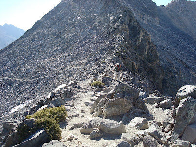
Nice view. I'm certain we went up and over these somewhere.
Day 13 - Up at 6, on trail 7:30! Up Bear Ridge 2000+ ft. immediately. Whew. Over 3400 ft. vertical today. 10 miles. Tired! Outfitter told us good sites, only 1 mile from Bear Xing, a little uphill. It was 1.5 miles and ALL uphill. Exhausted. In bed now at 7:30 p.m.

Dominic, Matt, and Andrew who joined them yesterday. We leapfrogged with them a number of times up to this point. Never saw them again after.
We finally made it to Rosemarie Meadow and collapsed into the first campsite we found. I swore I'd take my revenge on that outfitter for telling us it wasn't much uphill. But, again, we made it and before many others that ventured to that point that night.
Day 14 - Met Glenn and Corinne (father and daughter) from San Diego, CA and Pocatello, ID. Also ran across Andy and Paulette from Bozeman. Ranger Doug, too. He has long time friend, Miles, who works as backcountry ranger in Weminuche Wilderness in our neck of the woods. Matt came to campsite. He carries two books with him, one by Tolstoy, another on how to learn Russian! He has very slow friends, Dominic and Andrew.
Marie Lake - fabulous view. Decided to put caption on picture of Susan and Ranger "After a dozen or so complaints, Ranger Doug had no choice but to issue Susan a ticket for going too slow uphill."
Glenn and Corrine having a father daughter adventure.
Andy and Paulette were moseying along, just like us.

Oh man, Susan's in trouble now!
Actually, Ranger Doug was quite nice and chatty. He did ask to see our permit though so Susan is getting it for him.
This is the photo that I was going to caption
"After about a dozen complaints, Ranger Doug had no choice but to issue Susan a ticket for hiking too slowly uphill."
Susan seems to think she is the slowest uphiller on the trail. I'm here to tell you, that is not the case.

Marie Lake. I just couldn't get enough photos of this beautiful, beautiful spot.

Pass Number Four - Seldon Pass 10,898 ft.

Marie Lake again. Can't help it. It was so breathtaking, we didn't want to leave it behind. You definitely should click on this for a larger view.

Just one of our lunch breaks along the trail.

Interesting rock configurations on our way to Sallie Keyes Lakes.

This is where we're headed, between those lakes for a nice campsite before going down to Muir Trail Ranch tomorrow.

View from our campsite. Not a single other person was in the area.
Day 15 - Down, down, down to Muir Trail Ranch. Pretty rustic. No rooms available so no showers, booo. Hair is gross. Resupplied. Found goodies in buckets i.e. medical tape, sunscreen, t.p. Used email and bought more fuel and bug spray. Thought we'd go on but after short uphill with new weight, decided to camp by river and visit Blayney hot springs. Primitive but quite warm. Gave trail names today. Susan is Juke Box and I'm Dreamer. Almost went with "Feet" and "Toes".

Muir Trail Ranch is one of our resupply locations. There is no road access so we mailed this one. We were quite happy to find that it had arrived as predicted.
We had hoped there would be a vacant cabin so we can rent it for the night and use their showers but, alas, that was not to be.
Here Patt is inspecting our claim check to make sure our bucket is ours and we are us.

Patt spent the day hauling these buckets out for backpackers. As you can see, we certainly weren't the only ones counting on more food here.

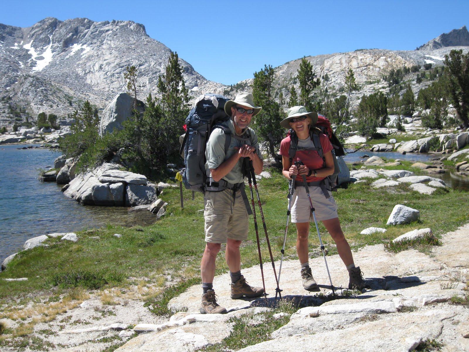
An accommodating hiker offered to take our photo here, the half way mark.
We still look pretty chipper don't you think?
We intended to get a few more miles out of the way when we left here but,
after climbing the short uphill out of the ranch with our canisters FULL of food and stuff, we decided to camp by the river and visit the hot springs we had heard about. That's the next best thing to a shower!

Of course, we probably wouldn't have had to cross a river to get to a shower.

The hot springs were in a grassy meadow area. Some were quite scary looking but we managed to find a nice, clear pool.
Susan is relishing the warmth.

I'm reclining and soaking up the warmth.
Susan's camera knew best. It tried to obliterate me!
This is not one you'd want to click on, I'm thinking.

Of course, our camp shoes were soaking when we returned to our campsite so Susan was able to model the latest campsite fashion for you.

Just for comparison sake, this is Susan happily hiking down the trail BEFORE the resupply.

This is Susan hiking down the trail AFTER the resupply.

Interesting log where we took a break.

Some local wildlife.

An interesting tree.

Entering Kings Canyon National Park.
Lucky we had no pets, firearms, or wheeled vehicles!

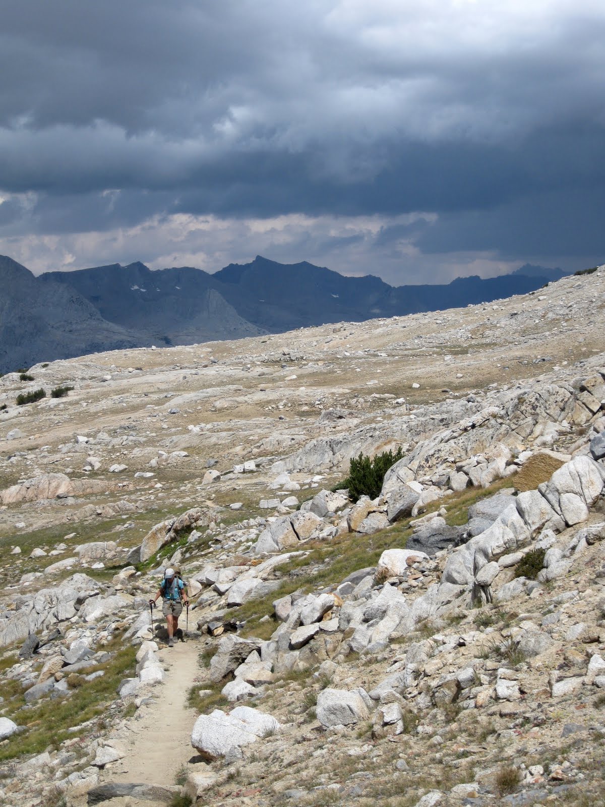
The terrain had changed somewhat as we proceeded south.

Always nice to find a bridge over some of those waterways.

Some of the San Joaquin River.
This was the only wet water crossing we had to make the entire trip. There are advantages to going in August!

Susan setting up her TarpTent. It looks surprisingly similar to. . .
Susan taking down her TarpTent.

Now this is luxury - pub tables at our campsite!

A lovely fire to warm our bones.
As were sitting around I mentioned that, in the amount of time we had to think, consider, and talk, we could be discussing any number of topics. We could be pondering and solving world issues. Susan promptly pointed out that she wasn't very "worldly" and I had to admit that neither was I. We dropped that line of thinking and turned our attention to more personal matters such as which of our dinners we would eat that night. There was no more crazy talk about solving anything for anybody else.

And plenty of trees for a clothes line.
You may have noticed that during the day, while hiking, we're in short sleeves and sometimes shorts and we mention how hot it was. And it was.
But, once that sun went behind the mountain and first thing in the morning, it was quite cool. Thus our capilene, fleece, and down outerwear.
Last thing I did each morning was change into hiking clothes. Took about 3 minutes to heat up!

As we continue on, we decide to take a snack break at McClure Meadow.

Susan decided it might be a good "rest my eyes" break, too.

Pretty scenery along the way.


Susan crossing some water on conveniently placed boulders. Do you think those trail crew workers have been here?

I don't know how local he was nor how wild but he is a part of my "wildlife" pics.

Sapphire Lake.

That couple set their tent up right next to me! I was in mine getting organized and, wha la, there they were. The entire wilderness and they're 5 feet from me.

I woke Susan from a nap, I think.
I was sitting out and noticed the moon up and the sun shifting. Thought I'd try some shots to see the difference as the sun went down.


Kind of fun to see.
We had intended to stay the next day at Sapphire Lake for our off day so we could wash hair (day 10 since last washing!), wash clothes, and rest. But, the weather had other ideas for us. We ended up going over Muir Pass that day instead. It was windy and the sky was full of fast moving clouds.

One of the myriad lakes we passed.


Muir Pass Hut built by the Sierra Club in honor of John Muir.
As it is located on a very exposed pass, hikers may seek refuge here during lightening storms. Not intended for overnight use, however.

Susan inside the hut.
You may notice that the fireplace is blocked off with stone now.
Wouldn't really matter since there is no wood within miles!
You may notice that the fireplace is blocked off with stone now.
Wouldn't really matter since there is no wood within miles!
One more photo before we head down the other side.

You might have noticed the terrain and entire feel of this area is quite different from prior days. I was quite anxious to get lower as I felt extremely exposed up here. It was quite windy and cold this day.

You might have noticed the elevation of the pass is almost 12,000 ft. Snow blocked the trail in several places and was quite prevalent here, in mid-August.

Susan taking a moment to absorb the view. We are headed somewhere out there.

Betsy following the trail across snow. A slip only meant an approximate 100 foot slide down into some boulders. No big deal!

We wound our way down and beyond this lake toward LeConte Canyon.
Day 18 - Planned rest day but woke to strong winds and cloudy skies. We packed up and headed to Muir Pass. Hut is cool. Tough slog up though. All area very stark and high. Winds cold. Headed down on some really tough trail. So glad not going up pass from south! 8.5 miles total, we think. Not far from meeting place with D and S. Tomorrow rest day for sure. Had two deer come into camp. One quite curious about tent. Toad pics are from Wanda Lake.

Heading down LeConte Canyon

Still heading down LeConte Canyon toward Big Pete Meadow where we'll camp for our rest day before we meet David and Shirley the next day.
Since we didn't get our rest day at Sapphire Lake, we'll take it at Big Pete Meadow. No big views but we found a nice campsite close to easy water and lots of big boulders and trees for drying our clothes. Heaven.

A curious visitor near Susan's tent.


Once we got our laundry tended to, it was our turn.

Susan getting her hair washed.

My turn for lathered locks. It had been ELEVEN days and, I am here to tell you, that is too long!

Once that was all done, it was time for a nap on a warm boulder while the laundry dried.
Part of me could bag it and go out with them. Part of me says Finish It! You'll wish you had! Whitney - well - I don't feel strongly. Sets in how long 31 days is! Don't believe I'll do much more than 7 - 10 in the future. We'll see. Maybe I'll feel differently when it's done!?
David had repeatedly offered that we could came out with them over Bishop Pass if we were ready to end our journey. They were quite concerned about our well-being and quite generous with offers of assistance and exit. I must admit that it was tempting at times but we weren't ready for that, yet. As we headed toward our meeting location, we were still feeling good and ready for more. We awoke the next morning refreshed and full of energy. . . especially knowing we had only about an hour to arrive at the trail junction where we were to meet them!
Day 20 - 45 minutes to LeConte Ranger Station and Bishop Pass Trail junction. Met D and S! Hard hike for them. Took 1st site we saw. Nice visit. David happy to get rid of all that food. Shirley brought my socks - YEA!

Looking toward our meeting place near the LeConte Ranger Station beyond Little Pete Meadow. Somewhat different than back around Muir Pass, eh?

Here they come!

It was so nice to see familiar, friendly faces after 19 days on the trail!

The official handing off of the food ceremony.

The official handing off of the clean socks ceremony.
I was so happy. No matter how I washed my socks, they were still crunchy and one pair was about to wear through on the heel.

A nice sit and visit with David and Shirley. Shirley looks a bit tired but who wouldn't after the trek they had.

True to form, Susan retrieves some firewood.

We pose for one last photo before we all head out on our respective trails the next morning.
Those are goooood friends, folks.
Day 21 - Up EARLY. D and S headed out 6:45ish. Susan and I out by 8. Long, hard day. 7 miles to Golden Staircase. It was THE hardest day I've had so far. Staircase was 3 long miles of difficult up at midday - very hot. Beat and hurting back when arrived. First two sites wouldn't work. Had to go in grass. To bed very early. Lots of drugs (Advil).
My journal entry says it all. We arrived at the base of the Golden Staircase at 1 p.m. We would have preferred camping below and getting up it the next morning when it was cool but we didn't want to waste the entire afternoon so. . . up we went. It was full sun, very hot, barely a breeze, and some of the toughest trail we'd seen. I recently learned that it had to be dynamited out to make a trail at all. The difficulty was that it was like constant tall steps. One leg had to bear all the weight going up each step so it was quite exhausting. Keep in mind we had just taken on 5 days of food so our packs were about 8 lbs. heavier than the day before. Ack!
I still joke that that was the day I lost the joy. When we got up to Lower Palisade Lake, I was whooped. We found a site for the tents and when I went to put in my first stake, I hit granite. You know that demoralized feeling when you just have no more energy and things don't go as you wish? Well, that was it. All I wanted was to get my tent up before I completely gave out and nothing was cooperating. It was kind of funny, really. I just looked at Susan and sat down, waited a minute to regain my composure and looked for another spot. It couldn't happen again, I said. Hah! Same thing at the next spot. In my desperation, I set up my tent in a grassy area which I would normally never do in order to protect the vegetation in those exposed elevations. I just wanted to lie down.

A cascade emerging from the trees on our way to the staircase.

Saw this lizard and thought he was rather pretty. Black with a neon blue belly.

Looking back along the trail.

We're going somewhere up there.

My tent pitched in the grass with Lower Palisade Lake and roaming horses in the area.
There was an outfitter in the same area who had released his horses to graze during the night. They weren't a problem except a couple kept coming by our tents. I wasn't concerned they'd step on us or anything but I was concerned that one might decide to relieve himself one way or the other nearby and that wasn't an aroma I was looking forward to so I got out and chased them off, not with much oomph in my efforts, I admit. But they moved on.
Day 22 - I survived. Had to chase off horses grazing. Didn't want them pooping by the tents. Slept like the dead. Up early and climbed Mather Pass. Ran into old coot and learned it was 90 degrees day before! Talked to young man who didn't even know he had gone up Golden Staircase! Our jaws dropped. He was a triathlete person, had more muscles in one calf than I did in my entire body! He was gone in a flash. Was getting over Pinchot today - Ack!
Invited to share site with Tina. She is peak bagging, from CA, retired Cal Tech prof. Very nice. Sierra Club leader. Rain tomorrow?

Up and going early, we trekked on past Lower and Upper Palisades Lakes toward Mather Pass which, I think, is that notch in the middle up there.

View looking back towards the lakes as we climb.

With constant uphill, I needed to stop and stretch my leg muscles from time to time. Gives me a breather, also. Seems Susan caught me at it as she was jetting ahead.

Dramatic scenery up there.

Pass Number Six - Mather Pass 12,100 ft.

View on the other side, where we're going next!


Scenery on our hike down. It was refreshment to my senses to come down into the green grasses, wildflowers, and streams after being high in the granite mountains. They both held their own beauty and that was part of the sensory enjoyment, going from one to the other as we traveled along the trail.

Our campsite friend, Tina. She was climbing the peaks around the area and offered her site which was quite large and comfy.
Day 23 - Gruelling 11.7 miles, Mather Pass then down, down, down. Steps were really hard on feet and knees.
As seemed to be our pattern, we started uphill to Bench Lake once leaving Tina at the South Fork Kings River crossing. Our goal today was Woods Creek Xing, some distance away. We knew once we got over Pinchot Pass it was downhill the rest of the way. What I didn't know was what havoc that would be on my knees. Live and learn!

The views were breathtaking and, honestly, worth every step.
You can see the dark clouds this day. While they provided wildly lovely vistas, getting caught in a thunderstorm while on a pass was not on our list of favorite things to do.

Pass Number Seven - Pinchot Pass 12,086 ft.
We noticed immediately that there was no wind up there which was a treat in itself. The views on both sides were quite dramatic and it was difficult to make ourselves get going but we did, given the possibility of unpleasant weather in the offing. But not before a few more photos.

We're heading down to that area behind me.

Susan was sticking her tongue out at me and, just for that, I'm not putting the good one I took of her in here!

Pretty. We're heading down as it greens up.
We did stop and put on our rain gear at one point. We could see dark clouds and rain all around us and were certain we were fixin' to get pounded. After sweating along in that gear for a little while, we were astounded to see that, while everywhere within sight was getting wet, we were not. So, on we went after removing our rain gear.
We made it to the Wood Creek crossing with tired bodies. The bridge here was quite interesting. There were signs on each side instructing one person on the bridge at a time. When I walked across it was swinging a bit which was a strange sensation. While I was thrilled there was a bridge, I was skeptical that I could make it up those stairs because my legs were quite exhausted at this point. But, made it we did and found a good campsite on the other side.

As we're heading down.

We get to the bridge. I have to take a big "psyche up" breath to climb those stairs. Seems silly, I know, after climbing mountain passes and ridges but it's when we're at the end of the day that it seems almost impossible!

The cable bridge.

Susan stepping lightly on her aching feet after 11+ miles.
The next day we head to Rae Lakes which we were looking forward to as we'd heard they are quite lovely. We're going to camp just below the switchbacks leading to Glen Pass so we can head up in the cool morning hours.


It's not possible to describe what hiking through country such as this does to you. It's so beautiful, so grand, and so timeless. I often thought how lucky I was to have the opportunity to experience it.

As we pass by, we notice how clear the water is. There are a couple of islands that tempt us to swim over but we know how cold that water is and it becomes a passing thought!

As the sun sets it shimmers on the water.

The Painted Lady.
Click on this to see the stripes that run through her. She was just above our campsite.

It is about 5 p.m. and we both had to don our fleece and down. Across the way in the sunshine it was probably 20 degrees warmer. Once that sun goes behind the mountain, ooohee, cold.
I am absolutely, 100% ready to be done. Forester Pass is 13,200 and Whitney Trail Crest is 13,600. Not altitude that bothers me but elevation GAIN. 3000 ft. to get over Forester and 2400 to Trail Crest. No way I'm doing Whitney. Another 1000 ft. over and above getting up to where trail goes out. I'm whipped. I'd quit right now if I could - don't care who knows it.

This is our last campsite. We had discussed whether to continue on to Forester Pass and Whitney or go out over Kearsarge Pass, our last opportunity for an early departure. Personally, my body was so tired that I couldn't imagine getting any pleasure continuing on. It is virtually impossible to eat near the number of calories burned on a backpack this long. I felt completely depleted.
We decided to get over Glen Pass and see how we felt then make that decision.
Day 25 - I did not write in my journal at the end of this day. It turned out to be our last day on the trail, a decision we made when we met with the outfitter bringing up our last resupply buckets.

A view of Rae Lakes as we ascended Glen Pass.

The pass was rather narrow. It was quite windy and I was bracing myself with my hiking poles when Susan took this photo.

We met a couple of brothers who were also ascending the pass and one took our photo facing each side. We're trying not to get blown over backwards in this one.

Pass Number Eight - Glen Pass 11,924 ft.

There goes Susan along the trail on the other side.

There must have been a fire somewhere west. You can see the smoke line here.
We got to our meeting place about 10:30 a.m. and the outfitter, Bob, arrived about 15 minutes later. Good timing! It was at that moment that we decided to go out. The thoughts of a shower and a bed were like sirens singing us in!
Susan asked Bob if he could take our resupply buckets back down but only AFTER we got our cheetos out! We had been looking forward to those Cheetos for 10 days! He said he'd do whatever we wanted and offered to carry our packs out, too. That clinched it! The thought of walking the last 7 miles without a backpack. . . well, could it get any better?! So we pulled out our tiny daypacks we had stashed for summitting Whitney (another day, perhaps), put in food, water, and rainjackets. We gave everything else to Bob and he loaded it up and hauled it out. We'd see him and our stuff again at the Onion Valley Trailhead.

I'm holding Bob's horse, Handy, while he packs up our stuff.

Bob securing all our worldly belongings on Little John.

There they go. We have only to hike 7 miles over Kearsarge Pass and down to the trailhead. We'll worry about what happens after when we get there.
Bob had to get going because he was stopping at Kearsarge Lakes to carry some stuff out for other folks down there.
Bob had to get going because he was stopping at Kearsarge Lakes to carry some stuff out for other folks down there.

Susan about to dig in. It's not easy being cheesy, you know.

I am experiencing Cheeto ecstasy.

A view of Kearsarge Lakes as we pass by on the trail.

It's such a nice view, I thought we should share it again.

Pass Number Nine - Kearsarge Pass 11,780 ft.

Looking east from the pass. We have about 5 more miles to get to the trailhead.

Bob passes us by about 4 miles down. He said he was surprised he caught up to us. We said we were surprised he didn't catch up to us much sooner!

There they go, and our stuff with them.
Keep in mind that we had no idea what we were going to do once we got to the trailhead. Our car was about 50 miles away parked at Whitney Portal (our intended exit point). From Onion Valley trailhead, our new exit point, it is 14 miles to the little town of Independence. From there it is about 15 miles to Lone Pine, the little town east of Whitney Portal. And from Lone Pine it is another 13 miles to the parking lot at Whitney Portal. We had no idea how we were going to get from one to the other but we'd worry about that when we got down.
Luckily, it was Saturday so there were quite a number of people parked at the trailhead enjoying the trails and lakes. There also was a campground. Bob said he was driving to Lone Pine the next day and would give us a ride there so we were quite relieved to have that part secured. But, as we got closer to the end, we became more enamored with the idea of a bed and shower that night. It was quite windy and getting colder and camping one more night just didn't sound very appealing. So, for the first time in our lives, we decided to ask total strangers for a ride. Yikes!
Just then a huge black dog comes loping up to us. Her owner wasn't far behind. Susan asked if he was going to Lone Pine to which he replied he was driving through there on his way home to Ridgecrest (about another hour beyond Lone Pine).I asked if we could pay him to give us a ride to which he replied "No, we could not pay him for a ride but he would give us one" but one of us would have to ride in the back with the dog. I quickly volunteered for that so as not to lose the ride altogether. We quickly retrieved our packs and buckets from Bob, thanked him, and hightailed it to Barry's truck which was, fortunately, a double cab pickup so my "ride in the back with the dog" turned out to be in the back seat, not a pickup bed. Hallelujah!
Once in Lone Pine, he decided he would just go ahead and take us on up to our vehicle at Whitney Portal. That was huge! It was easily 45 minutes out of his way and saved us so much trouble. After waiting to make sure Susan's SUV would start after 30 days in the parking lot, he refused payment, asked us to pass on the favor some day, and went on his way. The world is full of nice people.
Once Susan remembered how to drive once again we quickly made our way to McDonald's for french fries and a soda! That got us to Ridgecrest where we secured a motel room and Mexican food! After we each had our 30 minute shower, we crashed for the night. I actually had trouble sleeping! I think the bed was too comfortable!

It was nice to relax on a soft bed at the end of the day.
We drove all the way home the next day (about 13 hours) and began thinking about where our next backpack would take place. But maybe after a little break!
I confessed to Susan that I felt really bad about our not making it the entire way, I knew that it was a personal goal of hers. She surprised me tremendously when she told me, "Heck, I'm thrilled. I didn't think we'd make it this far!"
I confessed to Susan that I felt really bad about our not making it the entire way, I knew that it was a personal goal of hers. She surprised me tremendously when she told me, "Heck, I'm thrilled. I didn't think we'd make it this far!"
I lost 8 lbs. on this adventure. I calculate that as 28,000 more calories burned than consumed. Visions of sugarplums danced through my head! That's a lot of eatin' to catch back up!
This was a journey of a lifetime and I am grateful I had the chance to do it. Even though the effort was great and sometimes painful, each day was full of beauty, awe, and everlasting impressions. I will never forget it.